| The Caribbean, a Digital Elevation Model |

|

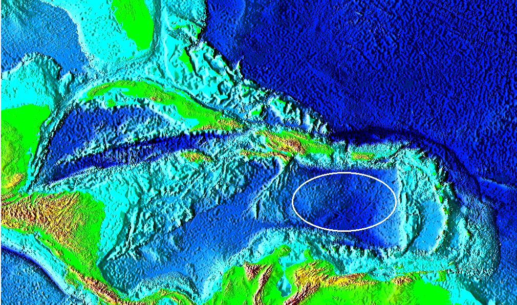
On the DEM of the Caribbean shown above, there is a grooved basin, or crater about 600 km long. The actual impact location is shown by the elipse.
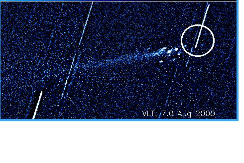
This impact site is but one of several from nuclei of a Comet which broke up over the Pacific Ocean. The Maya named the comet Seven Macaws. We can easily reason there were many large nuclei of various densities, which were accompanied by a mass of billions of tons of smaller nuclear particles in the coma of the comet. See the image of a comet breaking up in space below. Much of the mass impacted the Pacific Ocean and some just zipped through the atmosphere, slowing down. Some of the mass impacted the land in Central and South America and the Caribbean.
In the next section I will show where some of the other nuclei impacted in Central and South America.
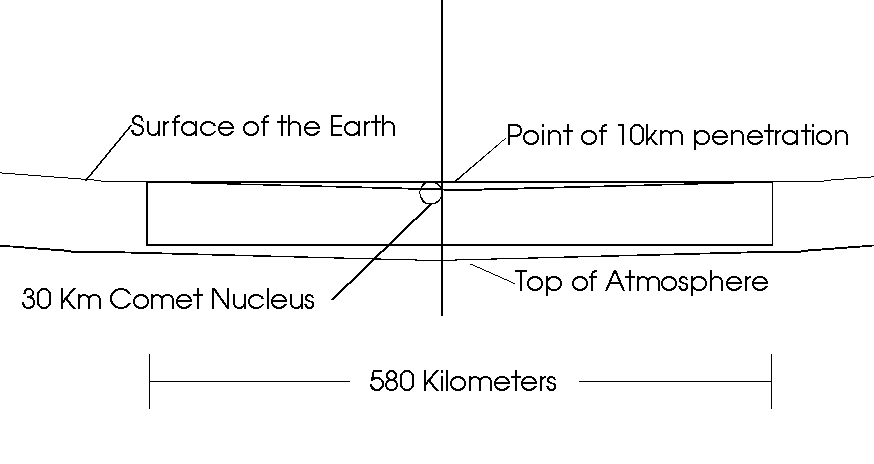
The hypothesis presented here, is that the grooved crater is from a tangential impact; that is, much of the mass skimmed along surface. The impact shown above is one of many nuclei of a large comet that broke up in its orbit around the sun, and brushed the Earth one day, not so long ago. The drawing below the DEM illustrates the path of a 20 km nucleus on a tangential trajectory penetrating to a depth of 10 km in the crust. This is the calculation of the depth that would need to be, for the chord to be the length it is.
|
|
For more information on the image below click on the image.
| Comet Linear breaking up in Solar Orbit |

|
This image shows the break up of of Comet LINEAR (C/1999 S4) into several smaller nuclei after it had passed through perihelion. The field of view is 103,000 km x 58,000 km at the comet. The nuclei are dispersed over a broad area and would result in several impacts if they collided with a planet. The diameter of the Earth at 12,800 km at the comet is drawn in for reference.
|


